Research project channel analysis
Development of a real-time capable channel analysis
time frame:
- Start of planning, preliminary discussion: Summer 2021
- Receipt of the funding decision and project start: 05-07-2024
- Planned project duration: 3 years
The project ‘development of a real-time capable channel analysis’ is part of the innovation network “Smarter Hochwasserschutz” (engl. smart flood protection). As a cooperation project between research and industry, it combines the scientific expertise of the Geodetic Institute and Chair of Building Informatics and Geoinformation Systems (gia) at RWTH Aachen University with the practical experience of W.A.S. Wasser-Abwasser Systemtechnik GmbH.
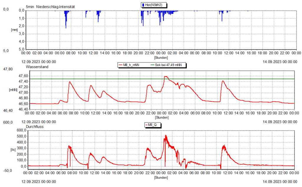
Climate change is leading to more intense and more frequent precipitation, which puts considerable strain on the sewer network and can lead to flooding in extreme cases. In order to be able to react quickly and in a targeted manner in such situations, the prompt availability of reliable discharge data and information on the current precipitation/discharge ratio is essential.
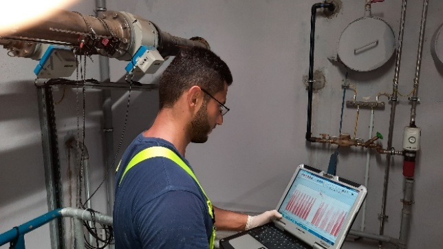
Modern sensors already enable detailed measurements for the evaluation and optimisation of sewer networks. However, the extreme in-situ conditions in the sewer infrastructure often lead to measurement errors such as outliers, drifts or offsets, which have to be corrected – a time-consuming and error-prone process. As these measurement errors can significantly affect the results of further analyses, data preparation is essential. For this purpose, each measuring station is calibrated during commissioning, the resulting data sets are analysed for possible drifts caused by deposits, corrected accordingly and then evaluated. This is an enormous challenge and time-consuming, especially for larger sewer networks. In addition, the results are not reproducible and can vary depending on the analyser, as an experiment on the manual preparation of environmental sensor data shows (Jones et al. 2018). This can be remedied by precise specifications or automation.
The aim of the project is to develop a real-time-capable analysis of the sewer network, taking into account spatially and temporally high-resolution precipitation quantities. For the first time, all recorded measurement data will be automatically checked for existing errors and intelligently linked with each other. In addition, an assessment of the data quality will be carried out. The analysis should enable an automated interpretation of the current condition of the sewer network for the first time.
The main focus of W.A.S. GmbH is to automate data preparation and evaluation and to carry it out continuously instead of only selectively. To this end, innovative methods for recognising and correcting measurement errors are being developed and tested. This automation not only increases efficiency, but also ensures greater reproducibility and accuracy of the measurement results. A particular challenge here is the intelligent linking of different measurement data and their practical and realistic interpretation. With this approach, W.A.S. GmbH aims to make an important contribution to future-proofing municipal infrastructures.
As part of the project, the Geodetic Institute of RWTH Aachen University is concentrating on the development of a powerful streaming data pipelines and the modelling of precipitation distribution. Further information is available on the gia-website.
Source:
Jones, Amber Spackman; Horsburgh, Jeffery S.; Eiriksson, David P. (2018): Assessing subjectivity in environmental sensor data post processing via a controlled experiment. In: Ecological Informatics 46, S. 86–96. DOI: 10.1016/j.ecoinf.2018.05.001.